
Homepage : http://gd.fitb.itb.ac.id/
The Bachelor of Geodesy and Geomatics Engineering Study Program facilitates the application and development of scientific insight through learning with optimal guidance in professional development to comprehensively solve the problems of the nation and the world, both in academic, professional, entrepreneurial and public services. Education held in the Undergraduate Study Program in Geodesy and Geomatics Engineering is geospatial engineering, namely the creation and operationalization of system systems to enable the realization of a desired phenomenon by using geospatial scientific rules as a support system for policy making in an effort to optimize development.
Geospatial scientific rules are spatial aspects that indicate the location, location and position of an object or event that is at, above, or below the surface of the earth which is expressed in certain coordinate systems.
Concept of Education
The field of geospatial science and engineering expertise held in the Bachelor of Geodesy and Geomatics Engineering Study Program includes:
- Geodesy, developing science and technology related to geospatial modeling of gravity, plate movement, horizontal and vertical movement of the ground face, as well as various disaster phenomena
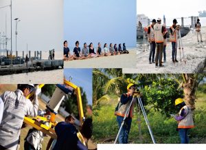
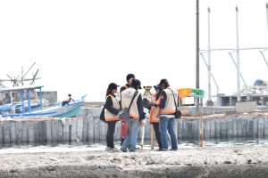
- Surveying, developing science and technology relating to the determination of the position, shape and size of objects and phenomena
- Cadastre, develops science and technology related to the relationship between humans and land, sea and air space, as well as regulation of utilization, control, assessment and taxation to achieve sustainable development goals
- Remote sensing, developing science and technology relating to the collection of geospatial information without making direct contact with objects and / or phenomena from a distance, especially using aircraft or satellites
- Geographical information science, developing science and technology related to modeling objects and phenomena as well as geospatial relationships between objects and / or phenomena in the framework of decision making
Science and engineering systems for coastal and marine areas, developing science and technology related to hydrographic engineering, sea boundaries, and coastal area decision-making support systems based on geospatial information
Facilities
Bachelor of Geodesy and Geomatics Engineering Study Program supported by Survey and Mapping Laboratory and Geospatial Information Laboratory. The Survey and Mapping Laboratory manages survey and mapping equipment with the latest technology. The Geospatial Information Laboratory manages the latest hardware and software to process, store, present, utilize, and distribute geospatial data from various sources.

Qualification of Graduates
Geodetic Engineering and Geomatics Engineering Undergraduate Graduates will get a Bachelor of Engineering (ST) degree after being able to show polite and educated behavior, speech, and appearance, can be part of an effective team, and be able to convey their ideas and knowledge honestly, based, structured, effective and accurate; able to formally convey ideas and knowledge in written or oral form and demonstrate the ability to use spatial engineering approaches, methods and / or technology to resolve a routine problem in a selected basic application field; and understanding the definition of its potential and role and being able to find, find and select facts and information relating to the application of basic geopacial engineering in a structured and independent manner.