South Coastal Hurricane Prone
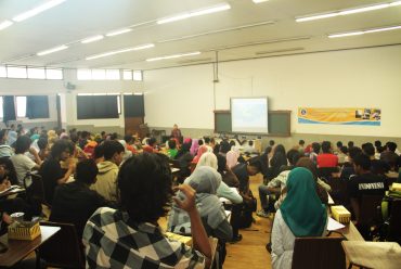
Sixteen point on the south coast of Java prone to storm accompanied by high waves in the ocean. Based on data from the Meteorology Geology (BMKG), over 41 years of high-wave peak usually occurs from January to March each year. It was raised oceanographers Institut Teknologi Bandung (ITB), Dr. Eng. Nining Sari Ning, when met on the sidelines of a seminar on “Managing Disaster Risk in State Maritime Indonesia, Thought Wisdom ITB Step Forward” in the Hall of Scientific Meeting ITB, Jln. Soerapatti No. 1 Bandung, Saturday (24/1).
“Zoning areas prone to storm surge is obtained based on case studies and George Jacob storm of Australia in March 2007. However, the data are qualitatively the same simulation results with the mass media reports during the storm on the Sea of South Africa in May 2007,” he said.
The sixteen spots identified are Tanjung Tereleng, Karang Taraje, Palabuhanratu, Gulf Ciletuh, Pameungpeuk, Tanjung Gedeh, Parigi, Gulf Pananjung, reclaiming, Tanjung Karang Stone, Pacitan, Munjungan, Gulf Tapen, Tanjung Pelindu, Tanjung Pisang and Cape Purwa ,
Nining said high waves in the ocean dangerous for fishermen and also affect the population around the coast. The storm caused the water level rises to exceed the high ground when the tide. In cases Palabuhanratu Kab. Sukabumi, the rising water can reach as far inland over 100 meters with a height of 50 cm from the shoreline. The incident was referred to rob or known by flooding caused by rising sea levels that one reason is the storm.
Nevertheless, according to Nining, the study still needs to be verified again with the data in the field. “Thus will henceforth obtain quantitative data on wave height, the height of water in each region, and so forth,” he said.
Nining said zoning disaster-prone areas of extreme waves is a result of research that can be used for disaster mitigation, particularly in the coastal areas. Thus, he said, the mitigation can reduce the number of casualties and damage to the environment.
“Zoning is also expected to be input for government in establishing appropriate coastal areas, integrated, and efficient,” he said.
Nining said, rob not only have an impact on social life and public health, but also the economy. He cited the floods that occurred in Muara Baru Jakarta, leading entrepreneurs in the fish has suffered a loss of up to Rp 10 billion per day. According to him, the damage and extreme wave disaster victims will get worse because of the decline in the carrying capacity of nature. This was caused by the change, damage, and environmental disasters due to increased development activities, as well as the demand for natural resources.
For that, said Nining, an understanding of the dynamics of extreme wave propagation is important to be studied in coastal zone management. “Especially for Indonesia, which has the second longest coastline after Canada,” he said.
On that occasion, Nining also revealed that the development of the science of oceanography should be optimally utilized. It is caused is still a lot of extreme wave propagation in oceanography dynamics that has not been revealed in Indonesia.
Subandono explained, physical mitigation is done by building houses on stilts for the communities around the coast. Countermeasures are also dilakukaan by planting coastal vegetation.
While mitigation nonphysical done by creating a hazard map that risk reduction was not disoriented. (A-185) ***
Source: Mind


No Comments