
As Earth Tells Si Si Tao Toba and Bukit Barisan
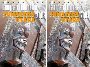
Bandung, fitb.itb.ac.id This article appeared in the book potpourri Geographic Expedition 2009 North Sumatra Indonesia (Bakosurtanal – Coordinating Agency for Surveys and Mapping Agency).
book cover
“Basic fish you boy!”
Suddenly the earth shook violently. The massive earthquake that shook the mountainous land. Longitudinal fissure cracked ground. Soon the water gushed out unceasingly through the cracks-cracks of soil and rocks. On top, dark clouds hung heavy in the black sky. Lightning strikes the earth with a thrilling voice. Rain was pouring down continuously. The new Toba realized, to his expletives Naidoo has been opened should closely guarded secrets about the origins of his wife, who had a pretty big fish that once he gets.
Remorse came later. Water soon flooded the valley where the Toba is located and drown. That reward for taking care of their children impatience Naidoo who is naughty and voracious eating. Naidoo, on the orders of his mother, who again changed into fish, survived the climb up the hill. Valleys were flooded area was later turned into a lake, Tao Toba. Bukit Samosir place to escape into the island.
Thus the legend of Lake Toba is known in children’s stories archipelago. Moral of the story reminds us to always patient care of children and maintain the honor of the household. But behind it is implied extraordinary natural events on the formation of Lake Toba. Geologically already known how the largest lake in Indonesia is formed through the events paroksismalis between activity and tectonic plate movement, volcanic eruptions.
Rampino and Self (1993) suspect that the Toba eruption has produced volcanic ash eruption 2,800 km3 as high as 40 km into the sky which then can lead to cooling of the Earth‘s surface suddenly. Rampino and other researchers call the phenomenon of global cooling as a “volcanic winter”. Earth’s temperature fell an average of 3 – 5 ° C. It is probable eruption 74,000 years ago affects the inhabitants of Earth and humans at that time. Globally known of the symptoms associated with the bottle neck populations declined drastically human population coincide in time 74,000 years ago. In the archipelago, with the evidence of fossils found in Java, Homo erectus, and humans are more modern types such as Human Wajak, most likely to feel the impact of the massive eruption of Toba great. Indeed, there is no strong evidence of the phenomenon of Toba caused the extinction of the human species, but the influence of climate change is certain to change the pattern of their lives.
Beginning in 2005, a view that has finally recognized misquoted by researchers from Monash University in Australia, Raymond Cas, stating their giant mass of magma beneath Lake Toba supervolcano to erupt as. The opinion makes this panic immediately contradicted many experts. Even if the mass of magma does exist, but the massive eruption will not happen in the near future. Of course we do not expect the paroxysmal eruption of the Toba supervolcano, even if it can stop the phenomenon of global warming phenomenon is happening lately.
SRTM image of North Sumatra with key locations referred to in this article
In Indonesia Geographic Expedition VI in 2009 in the province of North Sumatra, Toba tuff observed when the majority of the teams entered an exclusive area on the shores of Lake Toba in brand named Taman Simalem Resort. The place berdisain luxurious and chic, with a plaza just facing the beautiful Lake Toba northwest. Where previously the status of protected forest has been transformed into expensive tourist areas, including the construction of the temple which is close to completion.
Slopes of the plateau occurred at Toba in Brand cut and stockpiled (cut and fill) into a pattern of winding streets produce exotic scenery. Vihara placed at one end of the cape and flanked by steep slopes. This is where problems will arise. Steep slopes dominated by Toba tuff is loose and sandy, and prone to denudation. The symptoms of erosion and avalanches have started to appear. Developers seem to understand properly the problems to be faced. Some of the retaining walls and gabion stone are built to withstand the instability of slopes. Maintenance that will constantly have controlled so that it will be very expensive.
High levels of violence Toba tuff rocks are not only found on the slopes Lau Renun, Sidikalang, Dairi, or on the island of Samosir, but also reflected a very high waterfall and vertical Sipisopiso in Brand. Especially along the slopes are very steep gorge between Siguragura Sei Asahan and Appliances, District Porsea, Toba Samosir, Toba tuff rock glance looks like granite that need several times a powerful punch with a geological hammer to break it.
Sei Asahan as river drainage and where it comes out of Lake Toba is a maximum of 905 m above sea berpermukaan, eroded vertically and in Toba tuff rock follow the pattern of tectonic cracks. Tributaries into the valley Asahan as high waterfalls, outlines the water turns when the dew falls straight down the canyon walls. Sei Asahan stream leading to the northeast and then turn into a large river in Perhitian, Halado, once all the water out of the tunnel hydropower Stairs. The river eventually flows bermeander on the plains of the east coast of North Sumatra, to then empties as distributary rivers that meander in the delta environment in Teluk Nibung, Tanjungbalai. This place is a bustling harbor which becomes the Strait of Malacca to the boats for Selangor, Malaysia.
Cracks formed along the valley is also a way for the hot water discharge. Sipoholon hot springs near the measured temperature Tarutung 63,8oC become a bustling tourist spot. Sipoholon hot water out of the crevices of rocks and penetrate the Toba tuff. The precipitate formed by travertine hot water breaks Toba tuff produce precipitates with interesting patterns, such as the formation of stalactites and stalagmites, as well as the deposition of travertine terraces.
Land Batak Beautiful
At the end of the expedition exploring the history of Lake Toba eruption is exceptional as well as products tufnya widespread, the impression gained is awe landscape formed by natural processes, the processes of geological, tectonic and volcanic lasted berribu- thousand years. Lake, plateau, mountains, hills, valleys, and rivers, and forests, plantations and its people, North Sumatra entirely natural compile into a beautiful harmony of nature. It is suitable meanings as buts nauli Tapanuli, beautiful land. Let outsiders who roams just 10 days in North Sumatra, a native of Batak still always amazed with the land of their birth.
How to love the Batak against his native land, always exemplified when a Batak sang “O Tano Batak” (1933) written by S. Dis (Siddik Sitompul, 1904-1974) with most of the lyrics are as follows:
O Tano Batak sinaeng hutahap,
dapot honon hu, tano hagodangan hi
(Oh Batak who always longed for … Oh Land Batak always I looked up, I want always to return home to the land of birth).
How hard character of the Batak, his eyes glazed, maybe even sobbing, while singing the song. Moreover, when did this sense of homesickness while away wander.
O Tano Batak, I have always wanted to get back your beauty …
book
- Aldiss, D.T., S.A. R. Whandojo, Sjaefudien A.G., and Kusjono (1983), Geologic Map of the Sidikalang Quadrangle, Sumatra 0618, Scale 1:250,000, Geo. Res. And Dev. Centre, Bandung.
- Aspden, J.A., W. Kartawa, D.T. Aldiss, A. Djunuddin, D. Diatma, M.C.G. Clarke, R. Whandoyo, and H. Harahap (2007), Geologic Map of the Padangsidempuan and Sibolga Quadrangle, Sumatra 0717, Scale 1:250,000, Geo. Res. And Dev. Centre, Bandung.
- Bemmelen, R.W. van (1949), The Geology of Indonesia, Vol. IA, Martinus Nijhoff, The Hague, The Netherlands.
- Cameron, N.R., J.A. Aspden, D. McC Bridge, A. Djunuddin, S.A. Ghazali, H. Harahap, Hariwidjaja, S. Johari, W. Kartawa, W. Keats, H. Ngabito, N.M.S. Rock and R. Whandoyo (1982), Geologic Map of the Medan Quadrangle, Sumatra 0619, Scale 1:250,000, Geo. Res. And Dev. Centre, Bandung.
- Clarke, M.C.G., S.A. Ghazali, H. Harahap, Kusyono, and B. Stephenson (1982), Geologic Map of the Pematangsiantar Quadrangle 0718 Scale 1:250,000, Geo. Res. And Dev. Centre, Bandung.
- Oppenheimer, C. (2002), Limited Global Change Due to the Largest Quaternary Eruption Toba 74kyr BP, Quat. Sci. Rev. 21 (14-15), pp. 1593-1609.
- Rampino, M.R., dan S. Self (1993), Climate-Volcanism Feedback and the Toba Eruption of ~ 74,000 Years Ago, Quaternary Research, Vol. 40, pp. 269-280.
- Verstappen, H.Th. (2000), Outline of the Geomorphology of Indonesia, A Case Study on Tropical Geomorphology of a Tectogene Region, ITC, Enschede, the Netherlands.
Ditulis oleh : Dr.Ir. Budi Brahmantyo, M.Sc (Anggota KK Geologi Terapan http://blog.fitb.itb.ac.id/BBrahmtyo)


No Comments